
Overview of our Online Maps
We are developing an online mapping platform tailored to land trusts. This platform will allow land conservancies to enter their geospatial data, which we will coordinate and present on a public website. This website will provide detailed information about trails, trail uses, restrictions, and conservation easements, supported by photographs.
The platform offers:
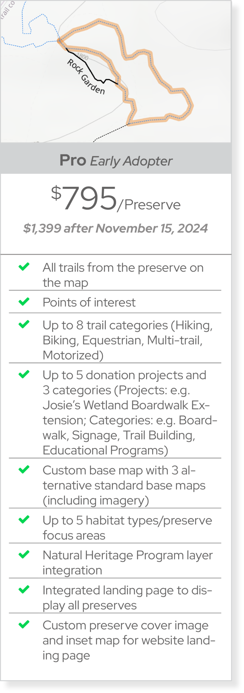
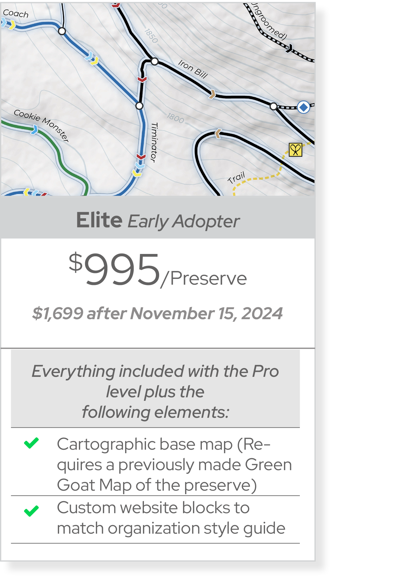
1. A Fee per Preserve Map Version (Pro and Elite Levels): Offering detailed maps and additional information that land trusts can integrate into their websites
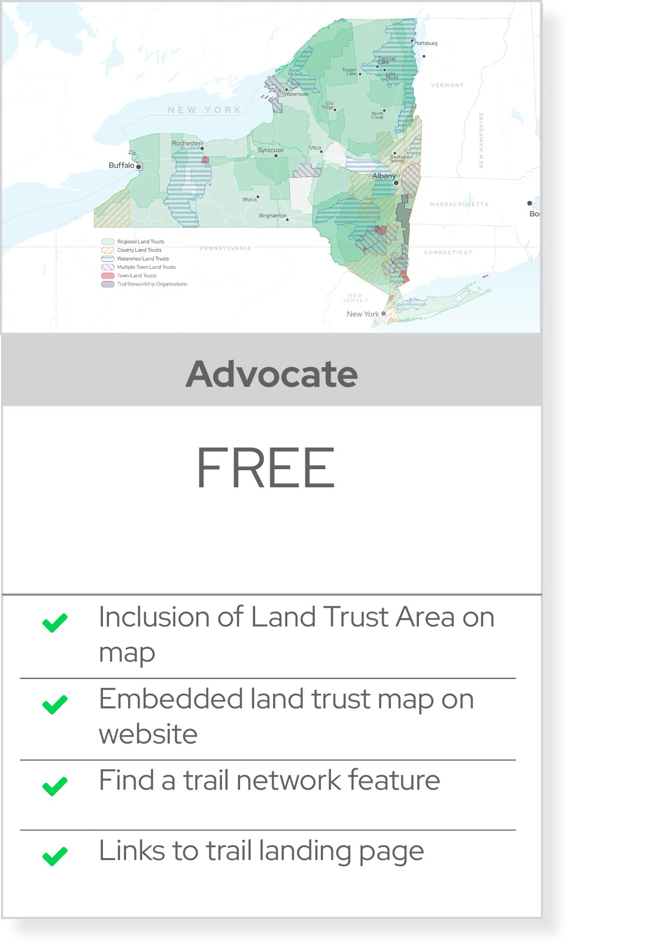
2. A Free Public Version (Advocate Level): Accessible to the general public, providing essential information about trails and conservation efforts.
By addressing the specific needs of land trusts, our platform will enhance public awareness and engagement with conserved lands, ultimately supporting conservation efforts.
The platform features:
Land Trust Specific Information: We will showcase data and information that are important for the land trust community. This includes trail information about accessibility and usage permissions; ownership or easement rights, special uses and/or ecological features, and land habitat information.
Filtering options: The platform will enable filtering of trails and preserves that cater to their audiences. This may include access type or ownership, accessibility, or activities.
Call to action: One of the most unique features of our map will be tailored calls to action. Land trusts will be able to highlight trail sections undergoing improvements and will invite the user to donate to specific trail projects or to unrestricted funds.
Integration and Customization: Our maps will offer customization of web maps to suite the needs of each land trust and for each trail network. We plan to launch four to five specific version of the web map for different property types.
Embedded Map Sample

Sample map mockup for a hypothetical preserve to show how the map will look on a website for the final project.
Landing Page Sample

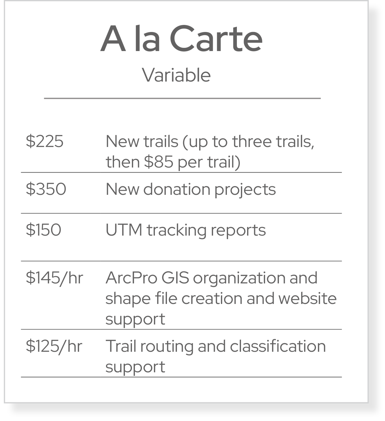
Pricing
Warning: A non-numeric value encountered in /home1/adirond8/public_html/wp-content/plugins/photoswipe-masonry/photoswipe-masonry.php on line 359
Warning: A non-numeric value encountered in /home1/adirond8/public_html/wp-content/plugins/photoswipe-masonry/photoswipe-masonry.php on line 359
Warning: A non-numeric value encountered in /home1/adirond8/public_html/wp-content/plugins/photoswipe-masonry/photoswipe-masonry.php on line 359
Warning: A non-numeric value encountered in /home1/adirond8/public_html/wp-content/plugins/photoswipe-masonry/photoswipe-masonry.php on line 359
Warning: A non-numeric value encountered in /home1/adirond8/public_html/wp-content/plugins/photoswipe-masonry/photoswipe-masonry.php on line 359
Why Choose Green Goat Maps?
• Advanced Mapping Solutions: Our online mapping solutions are designed to be user-friendly, visually appealing, and highly functional, providing detailed and interactive trail maps.
• Customizable Templates: Our templates are customizable to meet the specific needs of your trail system, ensuring that your maps are both informative and engaging.
• Expert Support: Our team of experts is here to assist you with the setup, customization, and maintenance of your web maps, ensuring a seamless experience.
How to Apply
To take advantage of this special offer, please contact us at info@greengoatmaps.com or visit our website at www.greengoatmaps.com to learn more and sign up.
Join us Today
Don’t miss this opportunity to be a part of the Green Goat mapping project as an early adopter. Secure your reduced rate and enjoy the exclusive benefits designed to help you maximize the potential of your trail systems.