

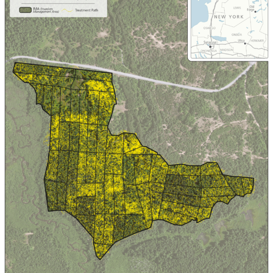
Fort Drum – Cantonment Area Herbicide Application
Adirondack Research implemented a large-scale understory invasive species management program across the cantonment area of Fort Drum, treating approximately 64 acres across multiple Invasive Management Areas (IMAs). The project focused on reducing dense invasive shrub layers to support native regeneration, improve forest structure, and enhance habitat conditions within highly managed landscapes. Design map to emphasize treatment intensity, spatial coverage, and operational movement within defined...
Fort Drum Beech Control – Hack-and-Squirt Herbicide Treatment
American beech (Fagus grandifolia) can become an undesirable species in managed forest systems when it forms dense understory thickets that suppress regeneration of desired tree species. At Fort Drum, this condition is common in previously harvested areas, where beech root sprouting has resulted in high-density regeneration that limits forest diversity and habitat quality. In 2025, Adirondack Research partnered with Atlas Contracting Solutions LLC to...
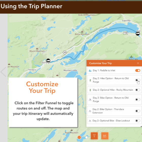
Hamlets to Huts Website Maps
We worked with Hamlets to Huts to design several multi-day outdoor trips. These interactive maps feature daily itineraries and direct instructions so travelers can safely navigate the Adirondack backcountry waterways. Fulton Chain Circuit - Paddle and Bike: Blue Mountain Lake Paddle Traverse: Raquette Lake Loop:
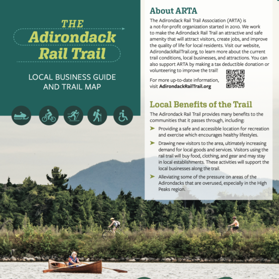
Adirondack Rail Trail Map and Brochure
We created a map and tri-fold brochure for the Adirondack Rail Trail Association (ARTA) to update people on the current status of the rail-trail project now that it is partially usable. ARTA needed a brochure and map to show where the trail is, when it will be completed, and what businesses are in the community to support trail users. We created a map...