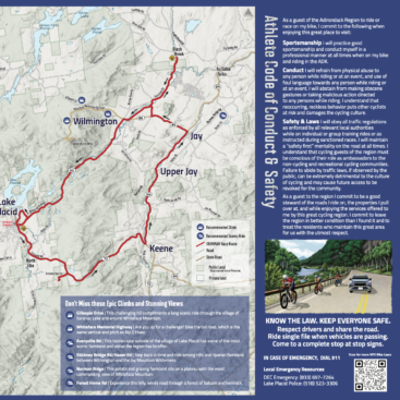
About the Project
We worked with our client, the Regional Office for Sustainable Tourism (ROOST) in partnership with the Town of Jay to create a kiosk map showing the three villages of Upper Jay, Jay, and Au Sable Forks. The purpose for this map and kiosk display was to help support the tourism economy in the Whiteface Region of the Adirondack Park. Having a centralized roadside map increases patronage to local businesses and emphasizes the offerings of small towns for both visitors and residents. The map and kiosk was designed specifically to cater to visitors, but we also knew that local residents would appreciate seeing local businesses in the map.

In this map, there are lists of dining and lodging, culture and shopping, trails and parks, and other services. In addition to the map and local business guide, this kiosk also features a QR Code that links to the Whiteface Region website. Our client’s goal was to increase connectivity between the villages within the Town of Jay to one another and to other towns in the Whiteface Region to promote tourism across the larger region.
Challenges
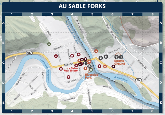
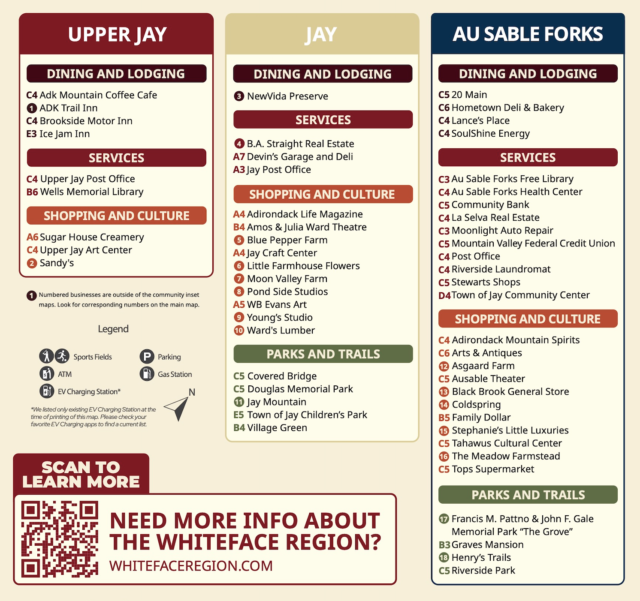
Our biggest challenge when producing the kiosk map for the Town of Jay was to show the current businesses while making sure the map did not go out of date with the addition of new businesses or with changes in business names. We opted to use a grid and and location code next to each business name on the right side of the kiosk. We also printed the right side panel with the business names as a separate piece that could be inexpensively reprinted every few years if needed. The right panel (pictured below) can be removed and replaced with four screws.