
What do we do with Data?
At Adirondack Research, we have a tagline that explains almost all of the work we do. That tagline is “We use science to inform decisions”. What’s interesting is that in all the work we do with science and data collection, we don’t often make decisions with the science we conduct. Most of the time we just collect, analyze, or simply move data to a place where it can be utilized by decision makers. In this post, we’ll describe how we partner with the New York Natural Heritage Program (NYNHP) to utilize a data resource called iMapInvasives on a variety of projects across New York State. iMapInvasives is an invasive species-focused data hub that is managed by NYNHP that connects us with many of our other invasive species partners, including the Lake George Land Conservancy, the Fund for Lake George, the Adirondack Park Invasive Plant Program PRISM (Partnership for Regional Invasive Species Management), the Capital Region PRISM, and the NYS Department of Environmental Conservation. All of these partners produce and utilize data on invasive species in New York, and all of those data rely on iMapInvasives as a data hub. Below are some highlights on how we have been working with NYNHP and the iMapInvasives platform to support the work we do with these state partners.
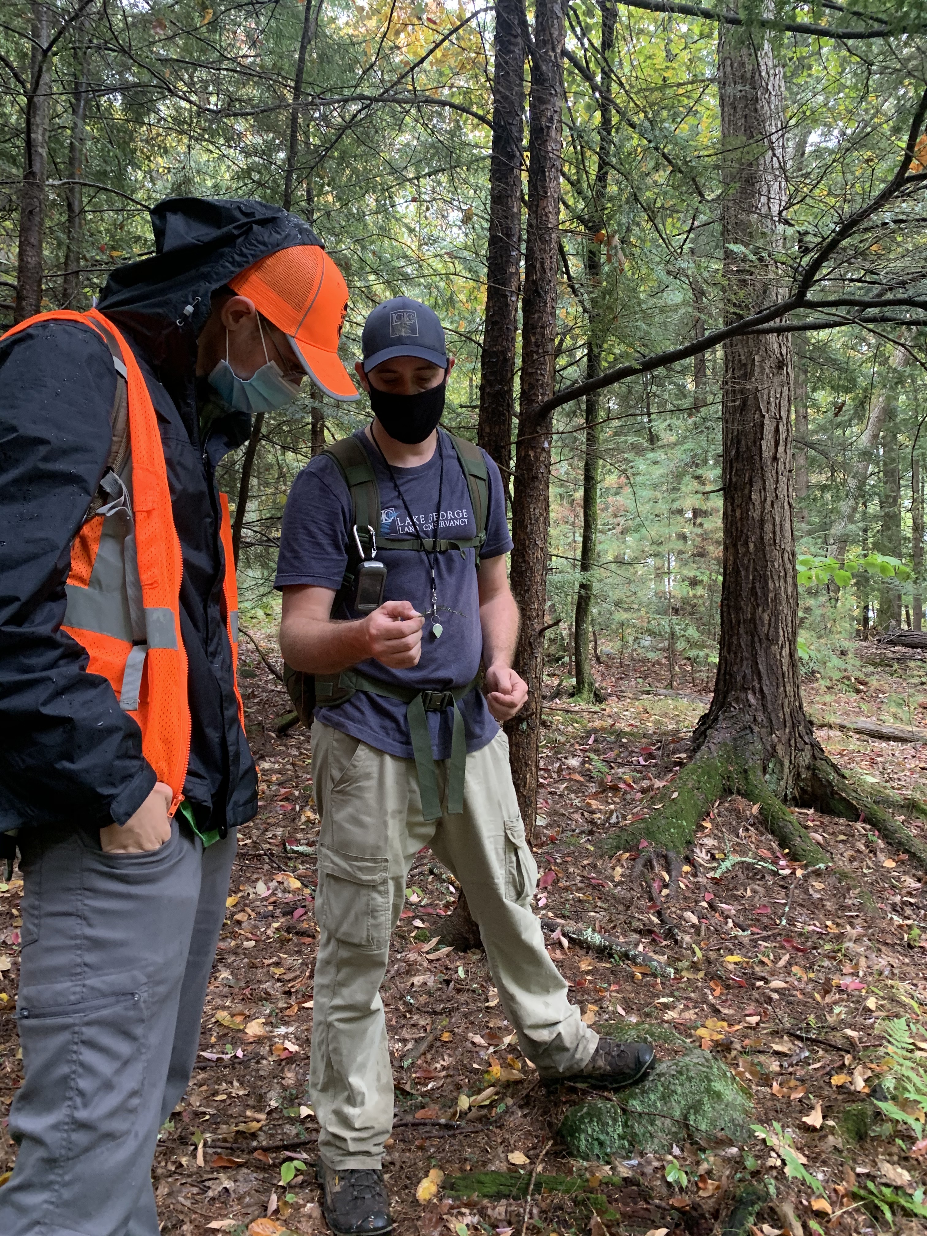
Many of you have heard about the hemlock woolly adelgid’s (HWA) new appearance in the Adirondacks. To combat this invasive forest pest, we have been working with the Lake George Land Conservancy, the Fund for Lake George, and the Adirondack Park Invasive Plant Program (APIPP), to survey for undiscovered populations on the shores of Lake George. Our team does on the ground research hiking into Lake George’s forests guided by a NASA satellite model that we created ourselves to locate hemlock tree stands (these are trees that could potentially be infested). Our team travels to those stands and checks for HWA, then measures tree stand composition to verify our model’s accuracy. Our ground verification helps us to check in with how our model is doing and allows us to improve it. We also send data on HWA occurrence (and absence) to iMapInvasives and create a map of hemlock stands that they can use on their GIS data platform. One thing many people don’t realize about data is the importance of negative data—that is, data where we’ve documented that we didn’t find an invasive species at a point or in an area. Negative data is important because it shows where we’ve looked already, and where something has not been found. We can use this information to update our models, make plans for where we’ll look next, and make sure that when we continue our field work, we won’t return to that spot. This makes us better at finding invasive species, and makes it quicker to implement management plans when we do.
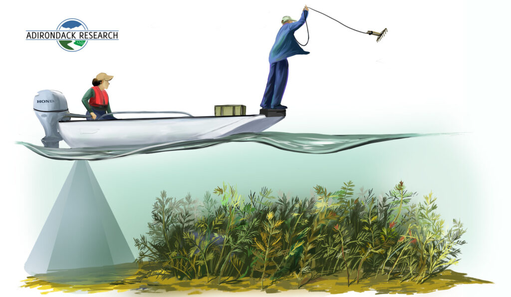
We have also been heavily involved with aquatic invasive species (AIS). In our work with APIPP, the DEC, and the various PRISMs across New York State, we have been conducting early detection surveys to find AIS in New York’s lakes, rivers, and reservoirs. These surveys are conducted by our crews from motor boats, utilizing rake-toss and visual monitoring, as well as hull-mounted sonar to map out plant beds located underwater. We collect and analyze terabytes of data each season on AIS beds, densities, and locations. These data we collect and analyze are often the only data available to lake managers.
What do we do with all of the species data to ensure that it is shared with partners across the state? How do we make this data available to other researchers, managers, and the general public? The answer is simple: we transfer the data we collect to iMapInvasives. iMapInvasives accepts invasive species data and makes it accessible among partners. When we and the people we work for contribute data directly into iMapInvasives, we work together to build a statewide accessible database of invasive species.
Working with partners like NYNHP and the iMapInvasives team helps us do better science. Sharing information, working hand in hand to develop models, and supporting one another with our different infrastructures allows us to fulfill the commitment enunciated in our tagline: We use science to inform decisions. Their infrastructure helps our partners, the people that hire us, and ourselves meet our commitment to finding and managing New York’s invasive species efficiently and well.

Leave a Reply