
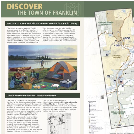
Town of Franklin Signage
We created kiosks for the Town of Franklin that feature the outdoor recreational opportunities available in the town. The map includes snowmobile trails, hiking trails, lakefront campsites, and road cycling routes. The kiosks highlight Kate Mountain Park and the Buck Pond Campground and Day Use Area. In addition, the kiosk shares information about the Haudenosaunee and the Six Nations Iroquois Cultural Center in...
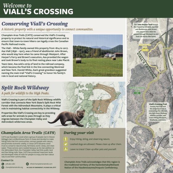
Viall's Crossing Signage
We created a new map and kiosk insert for the Champlain Area Trails(CATS) at Viall’s Crossing. The sign and map highlight the regional trail system as well as the trail’s access to the Westport business district. The map and kiosk will also educate users on improvements to the trails in the area that CATS is performing and will help users plan hikes and...
Upper Saranac Foundation Grant Application and Report Maps
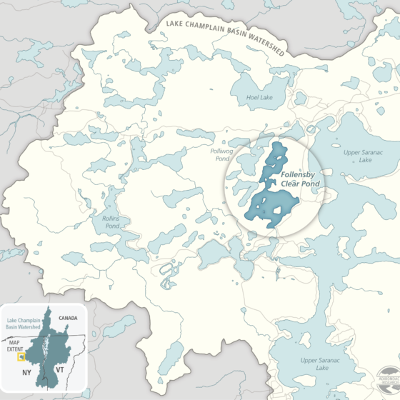
These maps were created for grant applications and grant reports for the Upper Saranac Foundation's milfoil management efforts on Upper Saranac Lake and Follensby Clear Pond. Client: Upper Saranac Foundation Medium: Digital Assets) Size: Website and print. Attribution: Nicole Keating was the cartographer and graphic designer.

Surveying Adirondack Lakes for Invasive Species
For the summer field seasons of 2018 - 2022, we have been contracted by the Nature Conservancy's Adirondack Park Invasive Plant Program to survey lakes throughout the Adirondack PRISM. We used data collected during these surveys to produce individualized lake maps of aquatic invasive species (AIS) distribution. Objectives for this project were twofold. The first being to detect and delineate any new or...