

Learn about the Invasive Species Management Initiative
Our Services
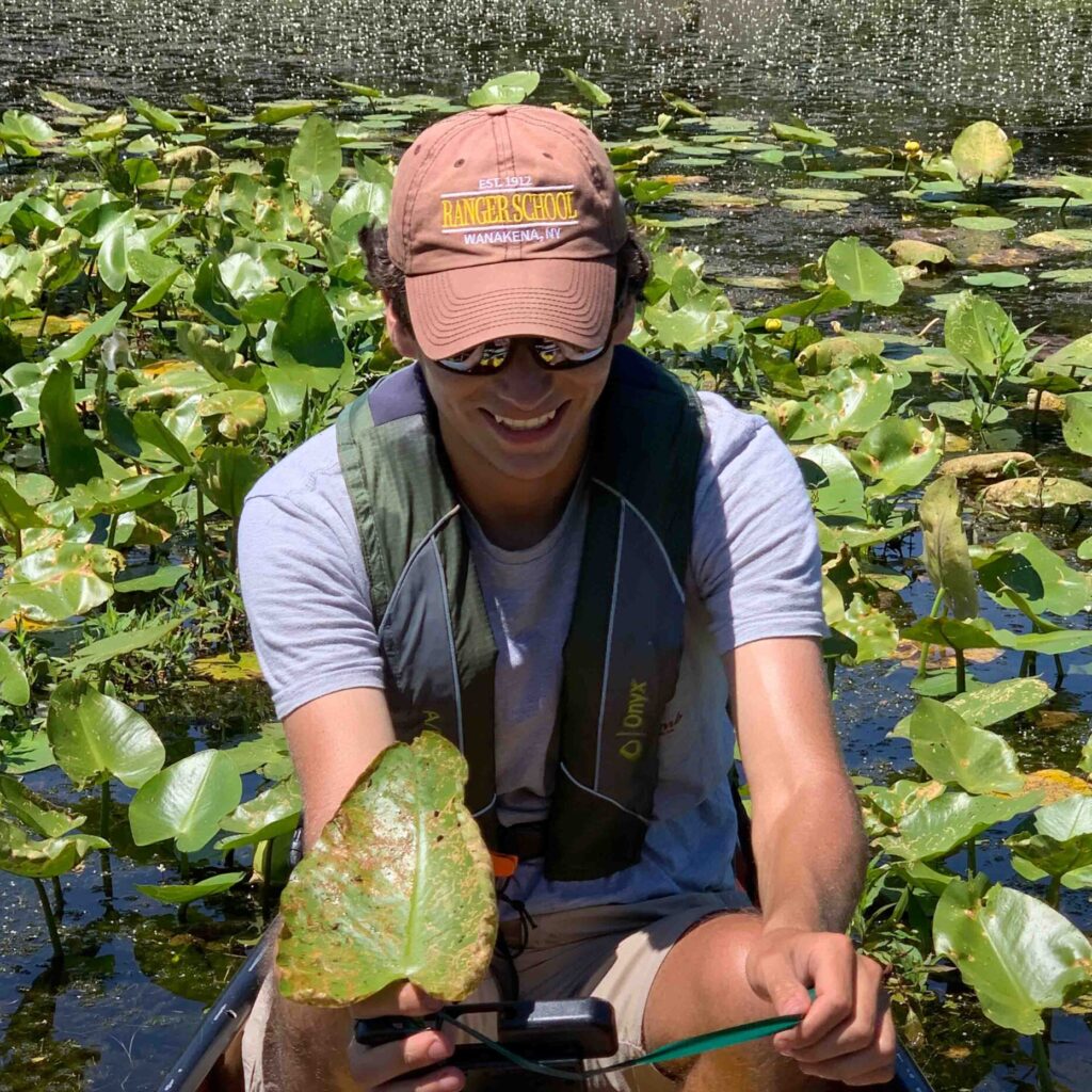
Invasive Species Surveys
Monitoring, planning for and mitigating the effects of non-native species.
GIS Mapping
Mapping and geospatial analysis for the environmental and land conservation fields.
Highlighted Projects
Peconic River – Long-Term Pre & Post Treatment Surveys
Invasive species are any kind of living organism that is not native to an ecosystem and causes some sortof ecological, human health, or socio-economic harm. In 2022, Adirondack Research, a private researchand mapmaking firm, contracted with the New York State Department of Environmental Conservation(NYSDEC) to survey portions of the Peconic River over a five-year […]
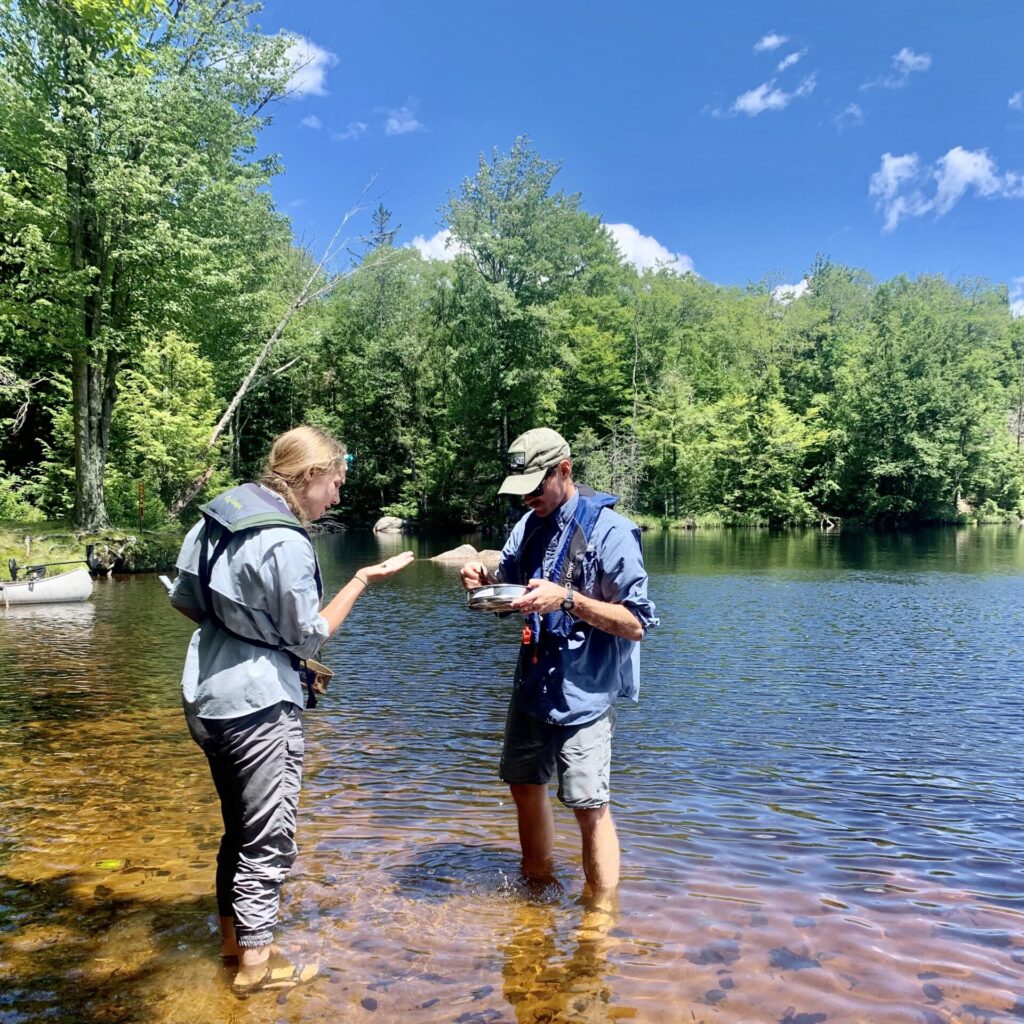
2022 Adirondack Aquatic Invasive Species Surveys – Early Detection Report
The primary objective of the AIS Early Detection Team was to detect and delineate any new or existing aquatic invasive plant or animal infestations within 42 prioritized lakes in the Adirondack Region. Additionally the team deployed Lowrance systems to map the vegetation beds, contour lines, and bottom hardness. These parameters help us gather important baseline […]
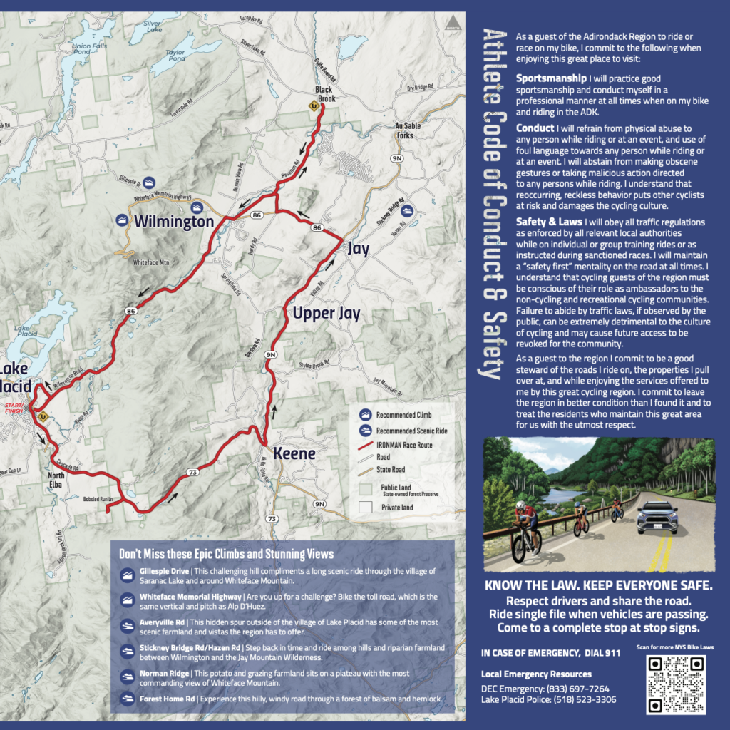
Ironman Athlete Map and Conduct Guide
We were contracted by IRONMAN to create an Athlete Conduct Map and Guide for the 2022 IRONMAN. IRONMAN’s goal for this project is to help athletes discover and explore a variety of communities along the cycling route and to educate them on safe practices on the roads. This is part of an effort to […]
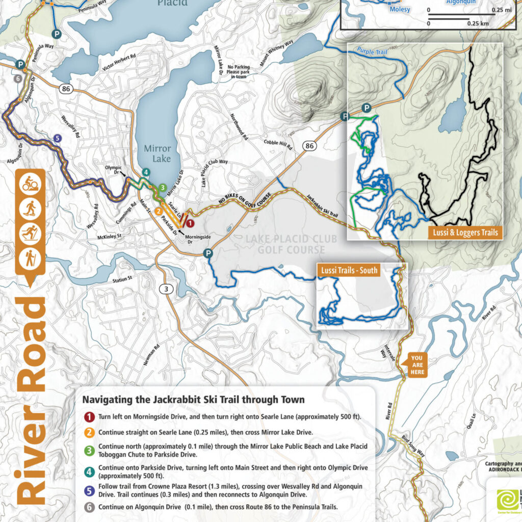
Trailhead Kiosks on Jackrabbit Ski Trail
These way-finding and informational signs were designed for BETA to enhance the trail users’ experience by aiding in way-finding, providing information on trail usage rules and regulations, trail etiquette, and on the history and role of the Barkeater Trails Alliance in building and maintaining trails in the region.
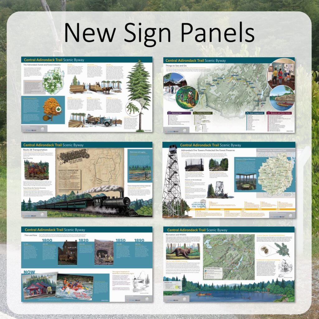
Central Adirondack Trail Scenic Byway Displays
We contracted with the Adirondack North Country Association (ANCA) for the NYS Department of Transportation to improve signage along the Central Adirondack Trail Scenic Byway. Traveling U.S. Highway 9, State Route 28, and State Route 8, the scenic byway traces a 153-mile-long trail through the heart of the Adirondack Park from Glens Falls to […]
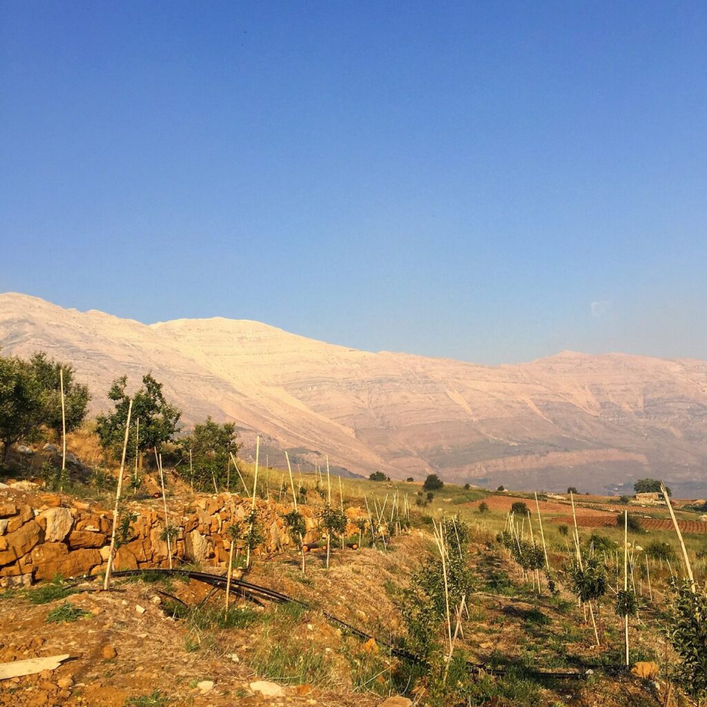
Protecting Lebanon Communities from Climate Change
We investigated the socioeconomic impact of climate change on two rural communities in Lebanon. Working alongside the U.S. Agency for International Development, the U.S. Forest Service, International Programs and the Lebanon Reforestation Initiative, our efforts were designed to help residents and farmers mitigate erosion intensified by climate change. The two areas focused on, El […]
Ezra completed a large set of assessments for us in a very short period of time. He was able to work with his team with short notice under pressing timelines as we were preparing to meet legislative deadlines. His work came in complete, at a very high quality, and provided us with the information we needed. He was also willing to accommodate a changing work-plan, which was very beneficial to us.

We contracted with Adirondack Research ad Consulting to coordinate our pheromone trapping program in Worcester, MA. Ezra Schwartzberg lead the effort and did an amazing job. The season’s trapping program went flawless, and his organization and management skills made our life A LOT easier. We were very impressed with his coordination with our lab, facilitating sample analysis, trapping logistics, and reporting. He also contributed a great deal to helping us calibrate our in-field volatile release rate. Adirondack Research and Consulting offers a great service and handles complicated survey methods with ease, professionalism, and timeliness. Very easy to communicate with too.

Ezra Schwartzberg helped with design, implementation, and management of the biological research infrastructure at Intervale Lowlands Preserve in Lake Placid, NY. We needed someone with broad expertise to advise on a long-term project with detailed scientific objectives as well as with many open-ended questions relating to climate change monitoring and management on private lands. Ezra was able to provide us with planning to facilitate our goals. We’re very impressed with his use of social media, smartphone apps, and crowdsourcing to make the data we collect useful to a broad audience.
Adirondack Research Team


Latest Blog
Our Clients


