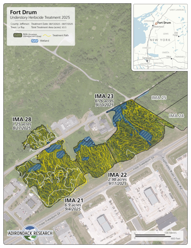
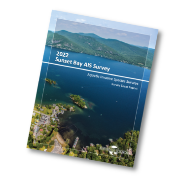
Adirondack Research implemented a large-scale understory invasive species management program across the cantonment area of Fort Drum, treating approximately 64 acres across multiple Invasive Management Areas (IMAs). The project focused on reducing dense invasive shrub layers to support native regeneration, improve forest structure, and enhance habitat conditions within highly managed landscapes.
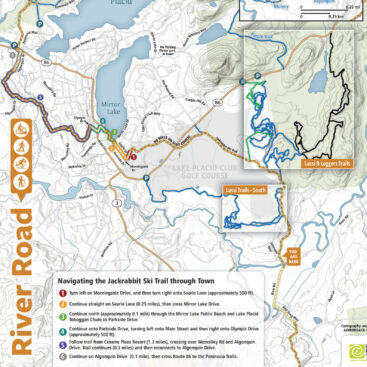
Design map to emphasize treatment intensity, spatial coverage, and operational movement within defined management units, providing a clear and detailed visual record of fieldwork.
Each map integrates high-resolution aerial imagery with IMA boundaries, GPS-recorded treatment paths, wetlands and exclusion zones, and dense thicket areas. Treatment paths—collected in real time during application—create a highly legible pattern that communicates both coverage completeness and methodical field execution. Individual IMAs are labeled with acreage and treatment dates, reinforcing clarity for reporting and long-term tracking.
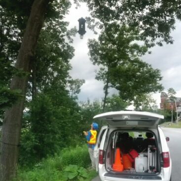
Field operations included foliar spot treatment and cut-stump application methods, targeting priority understory invasive species such as buckthorn and other woody competitors. All work was conducted by NYS-certified technicians and applicators using approved herbicides and tracer dye to ensure visibility and accuracy. Crews operated under strict federal compliance requirements, including environmental protections for wetlands, cultural resources, and sensitive habitats, as well as access and safety protocols required on an active military installation.
A key component of the project was the integration of field data collection with cartographic outputs. Daily treatment logs and GPS data were compiled into a cohesive mapping framework, allowing for precise documentation of where treatments occurred and how intensively areas were managed. This approach transforms the maps from simple visuals into operational datasets, supporting both verification and adaptive management.
By combining rigorous field implementation with clear, data-rich cartography, this project provides Fort Drum land managers with a transparent, defensible, and actionable record of invasive species control efforts, supporting ongoing stewardship and long-term ecological improvement.
Adirondack Research implemented a large-scale understory invasive species management program across the cantonment area of Fort Drum, treating approximately 64 acres across multiple Invasive Management Areas (IMAs). The project focused on reducing dense invasive shrub layers to support native regeneration, improve forest structure, and enhance habitat conditions within highly managed landscapes.
Design map to emphasize treatment intensity, spatial coverage, and operational movement within defined management units, providing a clear and detailed visual record of fieldwork.
Each map integrates high-resolution aerial imagery with IMA boundaries, GPS-recorded treatment paths, wetlands and exclusion zones, and dense thicket areas. Treatment paths—collected in real time during application—create a highly legible pattern that communicates both coverage completeness and methodical field execution. Individual IMAs are labeled with acreage and treatment dates, reinforcing clarity for reporting and long-term tracking.
Field operations included foliar spot treatment and cut-stump application methods, targeting priority understory invasive species such as buckthorn and other woody competitors. All work was conducted by NYS-certified technicians and applicators using approved herbicides and tracer dye to ensure visibility and accuracy. Crews operated under strict federal compliance requirements, including environmental protections for wetlands, cultural resources, and sensitive habitats, as well as access and safety protocols required on an active military installation.
A key component of the project was the integration of field data collection with cartographic outputs. Daily treatment logs and GPS data were compiled into a cohesive mapping framework, allowing for precise documentation of where treatments occurred and how intensively areas were managed. This approach transforms the maps from simple visuals into operational datasets, supporting both verification and adaptive management.
By combining rigorous field implementation with clear, data-rich cartography, this project provides Fort Drum land managers with a transparent, defensible, and actionable record of invasive species control efforts, supporting ongoing stewardship and long-term ecological improvement.